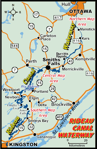
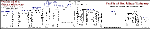
Rideau Region Maps ** Full Waterway Map ** View larger map of entire waterway Click on the map to make a selection, or choose from the links below: ** Full Waterway Map ** Satellite Maps (external links) Photo Tour Map Map Linked Lockstation Information Regional Road Maps North Road Map Central Road Map South Road Map Town Maps Burritts Rapids Delta Elgin Lyndhurst Kars Kemptville Manotick Merrickville Newboro Perth Portland Seeleys Bay Smiths Falls Westport Profile of the Rideau Canal Waterway Geology Map MORE MAPS (Paper and Digital) For a listing of the various maps and charts that cover the Rideau Region, jump to the:Maps, Maps, Maps Page which lists the various charts and maps that cover the Rideautogether with some suggestions on where to get them.
View larger map of entire waterway