HOME
About
Rideau Canal FAQ
Location Maps
Canal Statistics
Contacts
Ecology
Geology
History
Land
How to Get Here
Attractions
Accommodations
Coming Events
Boat Rentals and Tours
Visitor's Guide
Water
Boating Information
Fees and Schedules
The Locks
Marinas
Boater's Trip Planner
Paddling Guide
Activities
Boating
Paddling (Canoeing/Kayaking)
Driving
Cycling
Hiking
Fishing
Skating
History
Main History Page
History of the Lockstations
The Rideau Route
Communities
Geological History
Rideau Genealogy
Visuals
Rideau Photo Gallery
Rideau Photo Tour Videos
General
Articles of Interest
Tales of the Rideau
Behind the Scenes
Links
Brochures
Lake Associations
NEW
Your location:
Rideau Canal Home Page
>
Getting Here
>
Maps
> Rideau Canal Waterway Map
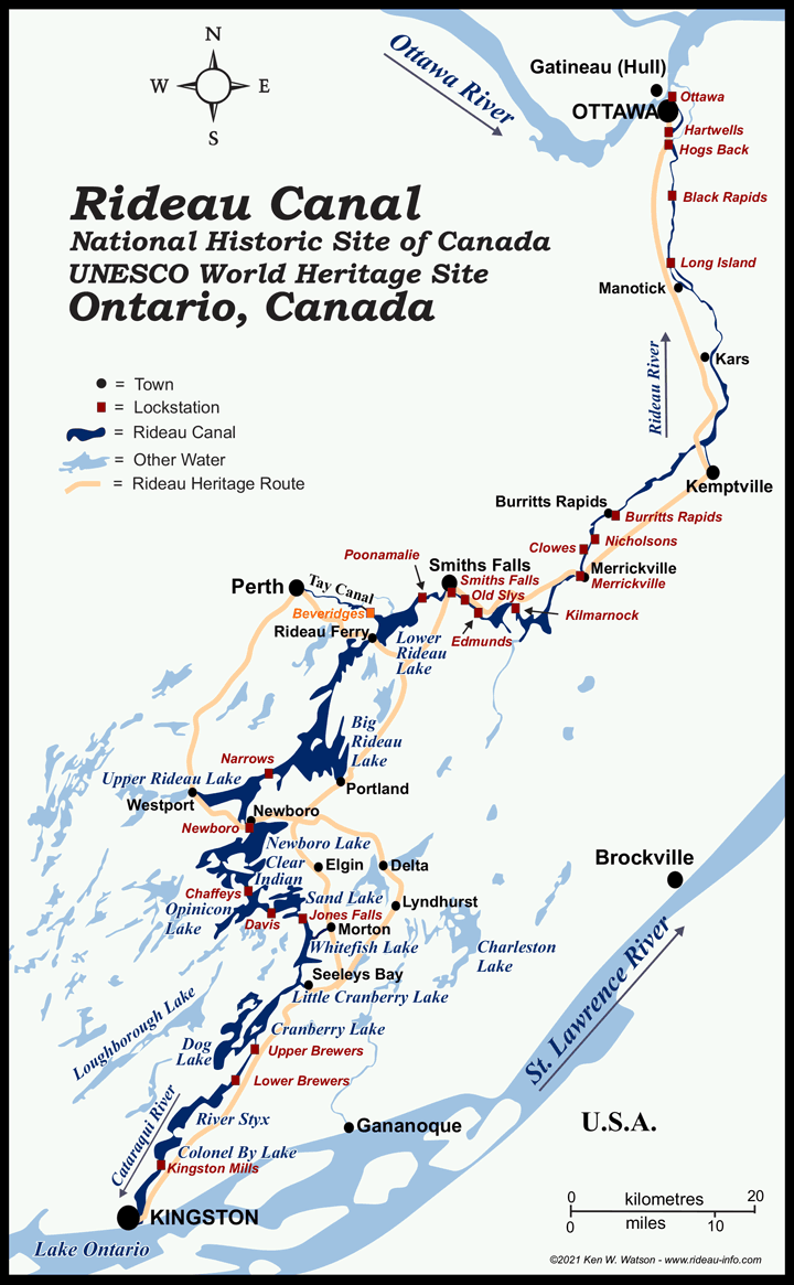
Map of the Rideau Canal
click on lockstation name or selected towns for more information
QUICK MENU
Home Page
Visitor Info
Accommodations
Attractions
Boat Rentals & Cruises
Brochures
Coming Events
Contacts
How to Get Here
Lockstation Information
Maps
Rideau FAQ
Visitor's Guide
Activities
Bicycling
Boating
Canoeing
Driving
Fishing
Golfing
Hiking
Kayaking
Photography
Shopping
Skating
Skiing
Snowmobiling
Boating
American Boaters
Boating Home Page
Boat Rentals and Cruises
Boat Launches
Fees and Schedules
Marinas
Lockstations
Paddling
Paddling Guide
Route Statistics
Trip Planning - Boaters
Trip Planning - Paddlers
Visitor's Guide
History
History Main Page
Your Rideau Ancestor
History of the Lockstations
The Rideau Route
Community Histories
Geological History
Tales of the Rideau
Photos/Videos
Photo Gallery
Photo Tour Videos
Ecology/Environment
Ecology Page
Water Quality Page
Wildlife Photography
General Interest
Articles of Interest
Behind the Scenes
Tales of the Rideau
Links
More Information
Contacts
Links
The Index (text links)
Comments: send me email:
Ken Watson
©1996- Ken W. Watson