Your location: Rideau Canal Home Page > Rideau Lockstations > Newboro Lock 36
| Number of locks: 1 |
Total Lift: 2.4m ( 7.7 ft.) |
Lock Through Time: 15 min.* |
| Chart No: 1513 (Sheet 3) |
GPS:1 N 44° 38.750' W 76° 19.270' |
| Chart Sales: Yes |
Lockstation Tel: 613-507-3183 |
| Washrooms: Yes2 |
Drinking Water: Yes3 |
Day Use Docking: Yes |
| Overnight Mooring: Yes |
Docking4 Upstream: 128m/420' |
Docking4 Downstream: 146m/480' |
| Ice: No |
Power**: Yes (U) |
Boater Camping:5 Yes |
| Boat Launch: Yes |
Picnic Tables: Yes |
BBQ Grills: Yes |
| Parking: Yes |
Public Telephone: Yes |
Self Guided Trail: No |
| Hwy Access: off Hwy. 42 in Newboro |
Lock Connects: Newboro Lake to Upper Rideau Lake |
| Civic Address: 10 Blockhouse Lane, Newboro, Ontario |
| Special Notes: To ensure passage, boaters must arrive at least 30 minutes prior to closing. Note that Newboro represents the "home port" for the Rideau. The adage, Red, Right, Returning for navigation buoys applies. If heading towards Newboro from either Kingston or Ottawa (going upstream), red buoys are on the right. If heading away from Newboro (downstream), red buoys are on the left. Therefore the "hand" of the buoys changes at Newboro. This is clearly shown on the charts.
|
Of Interest: This spot, originally called the Isthmus, marks the watershed divide between the Rideau River watershed and the Cataraqui/Gananoque rivers watersheds. The original plan was to build two locks at Chaffeys and simply have a canal cut through this neck of land, creating a huge summit reservoir (from Chaffeys to Poonamalie). But flooding concerns meant a change of plans, one of the Chaffey’s locks was moved to Newboro. When hard bedrock was unexpectedly encountered, a third lock had to be built at the Narrows. Newboro was converted to electric/hydraulic operation in 1966-67, the first of only two locks (the other being Black Rapids) to be changed from manual to electric operation.
The Sappers and Miner's Cemetery (originally called the Military and Civilian Cemetery and later the Presbyterian Cemetery) was used to bury those who died during canal construction at this site, including about half of the 22 Sappers and Miners that died during the construction of the canal. The original wooden grave markers have long since rotted away, leaving just a few field stones, which were likely used as footstones, marking the graves. Newboro also features one of the four blockhouses built for the defence of the Rideau Canal. |
| Notes: Gas is available at Stirling Lodge in Newboro. Newboro offers limited services (some groceries). Kilborn’s store offers an extensive shopping experience (several levels in three buildings). |
|
* Time to actually go through the locks. Allow at least twice this time when trip planning. See Schedule Caveats.
** U = upstream side, D = downstream side
1) GPS data should not be used for navigation. See the GPS page.
2) Washrooms are wheel chair accessible.
3) Unless indicated otherwise, water at the lockstation is potable.
4) Includes both blueline and greyline docking - see Lockstation Docking Page.
5) Allows tent camping for those arriving by water and also for cyclists and hikers.
|
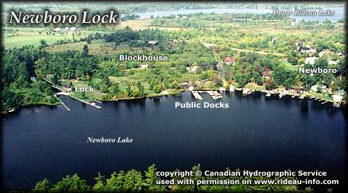 |
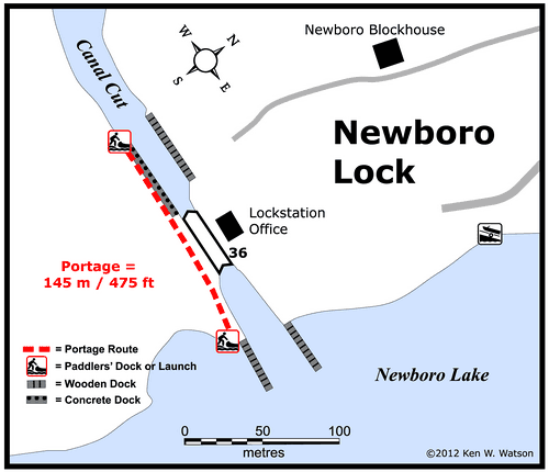
Newboro Lock looking NorthwestNewboro marks the watershed divide for the Rideau. All water south of here flows down the Cataraqui to Lake Ontario, water to the north flows down the Rideau River to the Ottawa River. Newboro is the "home port" for the Rideau so a navigation note is that the "hand" of the buoys changes at Newboro. This is well marked on the charts. The peaceful passage through the canal cut between Newboro Lake and Upper Rideau Lake belies the incredible difficulty encountered while building this section of the canal, the men battling hard rock with only the aid of picks and black blasting powder while at the same time being ravaged by malaria.
photo copyright © Canadian Hydrographic Service - used with permission |
Comments: send me email: Ken Watson
©1996- Ken W. Watson
|

