| Number of locks: 1 |
Total Lift: 2.3m ( 7.6 ft.) |
Lock Through Time: 15 min.* |
| Chart No: 1512 (Sheet 3) |
GPS:1 N 44° 56.770' W 75° 49.350' |
| Chart Sales: No |
Lockstation Tel: 613-269-4426 |
| Washrooms: Yes2 |
Drinking Water: Yes3 |
Day Use Docking: Yes |
| Overnight Mooring: Yes |
Docking4 Upstream: 29m/95' |
Docking4 Downstream: 23m/75' |
| Ice: No |
Power: No |
Boater Camping:5 Yes |
| Boat Launch: No |
Picnic Tables: Yes |
BBQ Grills: Yes |
| Parking: Yes |
Public Telephone: No |
Self Guided Trail: No |
| Hwy Access: beside Hwy. 2 |
Lock Connects: Rideau River to Rideau River |
| Civic Address: 495 Heritage Drive, Montague, Ontario |
| Special Notes: To ensure passage, boaters must arrive at least 30 minutes prior to closing. |
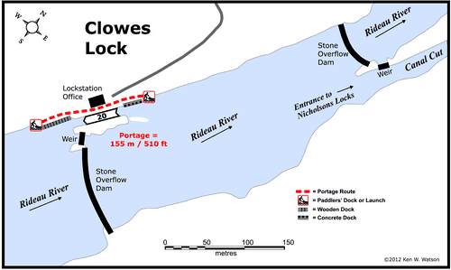
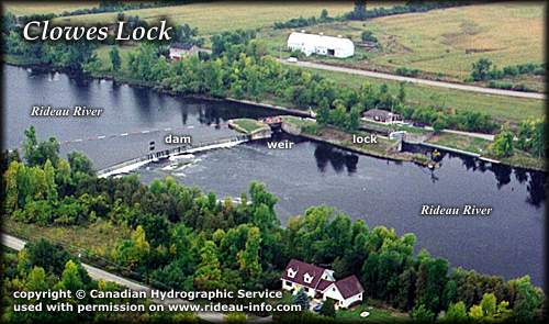
| Of Interest: Clowes features a single lock, a waste water weir and an overflow dam, one of the few used on the Rideau. Colonel By originally planned all his dams to be overflow dams, but his experiences with spring flood on the Rideau soon changed his mind, and he added waste water weirs (a water control mechanism) to most of the locks. However, at Clowes and a few other places, he left the main dam as an overflow dam, the height of the dam being the level of navigation. The addition of the weir allows excess water to be quickly discharged. |
|