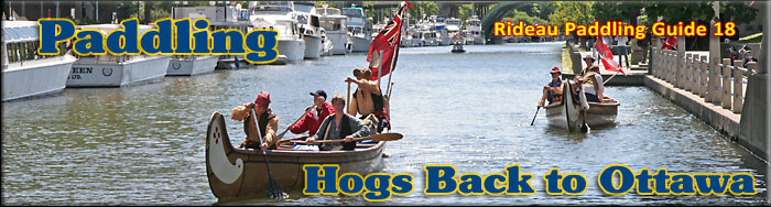
Paddling the Rideau Canal in Downtown Ottawa
(Hogs Back Locks to the Ottawa Locks)
This is an easy paddling canal section of the Rideau Canal that takes you right into downtown Ottawa. The map included in this guide can be enlarged (while viewing the PDF) to any level of detail you desire as an aid for travel planning.
You can view or download the PDF file:
| (Clicking this link will open the PDF. You can also just right mouse click the above link and use "Save Target As" to send the PDF directly to your computer.) |

Water Access
There are several points of water access. At the south end are the locks at Hogs Back and at Hartwells and the launch ramp in Mooneys Bay Park (fees apply). In the middle is the Dows Lake Pavillion (45° 23.760’N - 75° 42.360’ W) – there are parking and launch fees. There are three paddling access/egress points downtown. One is on the east side of the canal, at the canal end of Clegg Street (45° 24.280’N - 75° 40.825’ W). The two others are on the west side of the canal, one at the canal end of Waverley Street (45° 25.125’N - 75° 40.860’ W) and one on Patterson Creek (45° 24.480’N - 75° 40.950’ W) - access from the canal is under the small stone/concrete arch bridge.
Facilities
Lodging: If you're paddling and camping, the lockstations are a good choice for camp spots (a camping fee applies). Camping is allowed at all lockstations except for Ottawa and Smiths Falls Combined. There are a host of accommodations in Ottawa. For information about local accommodations see: www.ottawatourism.ca and www.rideau-info.com (this website).
Supplies: A local source for supplies is the city of Ottawa (and the many suburbs).
Big Boats
You'll be sharing the Rideau with big power boats (cruisers). The Rideau is generally not a crowded waterway and often you'll find the large boats in "packs" - travelling from lock to lock - once they pass by you won't see any for awhile. Some of these boats can generate a large wave. The general rule for a paddler and large waves is to meet them head on, this can actually be fun in a kayak (not as much fun in a canoe).
The main navigation channel is shown on the map as a blue dashed line - this is where the big boats will be travelling. So, if you wish to avoid these, pick a route away from the navigation channel. Many paddlers prefer paddling near shore, it's more interesting (i.e. wildlife, cottages) and it keeps you farther away from the waves produced by big boats.
There are several "no wake" zones on the Rideau - these have been marked on the maps. Boaters within these areas are supposed to be travelling at a slow enough speed (less than 10 kph) that their boat doesn't generate any potentially damaging or dangerous waves.
Wind
A question often asked is which way does the wind blow? The prevailing wind, powered by the jet stream, is from the southwest. That's about the only rule of thumb. If a front is moving in then the wind can come from any direction. I've been on several paddles where I've been paddling into the wind on the way out in the morning and into the wind on the way back in the afternoon because the wind swung around 180 degrees (for some reason it never seems to work the other way around - at your back both ways). So, if you're going to travel the entire Rideau, going from Kingston to Ottawa improves the odds of having the wind at your back - but be prepared for anything.
Etiquette
Your trip planning should include a "leave no trace" approach - carry out what you carry in. Many areas are un-serviced (no garbage cans) - so plan to be self-contained. The lockstations provide waste disposal facilities.
Preparation & Safety
Please read the trip planning information on www.rideau-info.com/canal/paddling/. While these lakes are easy paddling, normal paddling preparations should be made (all required safety gear, maps, food, water, first-aid kit, etc.). Zebra mussels are present in many areas along the Rideau, so a pair of water shoes (to avoid cut feet) is recommended.
Please take all normal safety precautions, including checking the weather forecast before you head out and making sure that someone on shore knows your planned travel route and itinerary.
Navigation
While the Rideau is generally easy to navigate, taking along a set of maps is a must (in addition to any GPS you might have). Although the map in this guide is an accurate 1:50,000 representation of the waterway (when printed to 8.5" x 11"), you may also wish to also have the 1:20,000 hydrographic chart for this section (Chart 1513). For power boat navigation, the charts are an absolute must (the map in this guide should not be used for power boat navigation). The charts are also very handy for the paddler, since they show the Rideau in great detail, including depths (which can be helpful when looking for wildlife habitat or just interesting places to paddle).
The charts also show all the navigation buoys. These are all numbered (red buoys have even numbers, green buoys have odd numbers) and so can be used as an aid in locating yourself on the map when you're on open water. A subset of those buoy numbers have been included on the paddling guide maps.
For those wishing to go off the beaten path or want to know more of the topography and geographic features of the surrounding countryside, the 1:50,000 NTS map for this section is 31G/5.
Distances:
Circumference distances are approximate, following the main shorelines. The navigation channel is shown on the map.
- Hogs Back Locks to the Ottawa Locks = 8.4 km (5.2 mi)
- Hogs Back to Hartwells Locks = 1.7 km (1.0 mi)
- Hartwells Locks to Ottawa Locks = 6.7 km (4.2 mi))
- Dows Lake (ramp) to the Ottawa Locks = 6.0 km (3.7 mi)
The Rideau Canal (in Ottawa)
This is a fully managed section of the Rideau not subject to natural water fluctuations. The main issue here for the paddler is that it can get choppy from waves generated by passing boats in the restricted channel sections. These waves bounce off the concrete retaining walls, sometimes creating tricky paddling conditions. So, please pay attention.
A paddler reported that during a heavy rainfall, storm water directed into the Rideau Canal can both produce an appreciable current at the outlet area and also fills the canal with street debris (cigarette butts and the like).
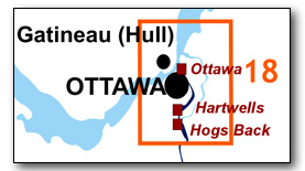
Hogs Back to Ottawa
In the pre-canal era, there was no waterway in this section. It was the area of land between Entrance Valley (adjacent to the Ottawa River) and Hogs Back (Three Rock Rapids on the Rideau River) consisting of meadows, forest and a large swamp (Dow's Great Swamp - a flood overflow drain from the Rideau River to the Ottawa River).
Today this 8.4 km (5.2 mi) section of canal is usually referred to as being all artificial (excavated), but that's not true, over forty percent (3.5 km /2.2 mi) of this distance was not excavated, it instead took advantage of natural topographic features, a gully that was flooded by a dam and a swamp that was also flooded by a dam.
To explain the geography and construction of this section of the Rideau Canal, I'll go backwards from our normal routing (south to north) and start at the Ottawa Locks (so go north to south) since this is how this section was built (Ottawa Locks first). I've marked some of the historic geography on the map so that you can visually see the locations.
The Ottawa locks are in a valley which had a bedrock ridge at the top (in fact bedrock on either side of the valley was quarried to get the stones used for the locks and buildings). A few hundred metres south was the Beaver Meadow - this easy digging area was used as a lay-by (the Canal Basin, a docking area) in the early days of the canal. Today this is the area of Confederation Park, the Mackenzie King Bridge and the Ottawa Convention Centre.
The canal then proceeds along The Deep Cut, a man-made canal cut which took the canal to the Natural Gully. The nice bit of topography provided by the Natural Gully was taken advantage of by erecting an embankment where the Deep Cut intersected the gully, in order to impound water. This is why the canal takes a 90 degree turn at that point, you're now in a natural topographic feature. The canal follows this gully for over 3 km (1.9 mi) to the Notch of the Mountain - a low point in a ridge that cut across the route. A cut (locally known as Mutchmor's Cut due to the proximity of a settler by that name) was excavated through the notch to Dow's Great Swamp.
At Dow's Great Swamp, Colonel By used his slackwater technique to achieve navigation, having one embankment built where the canal passed through (southeast end) and a smaller embankment built to the northwest, in a constriction in the swamp. These embankments created Dows Lake.
The rest of the canal from Dows Lake to Hogs Back was excavated in gravel and clay (bedrock was never encountered in this area until the canal arrived at Hogs Back).
A little bit of historic trivia is that the exact route you will be travelling, plus the dam at Hogs Back, were in fact Colonel By's second choice for the route of the canal in this section. His original plan was to simply run a canal cut from the Ottawa locks to the Notch of the Mountain. From there it would follow the present course but intersect the Rideau River at the foot of Three Rock Rapids (at the foot of Peter's Gully - about 270 metres north (downstream) of the present Hogs Back dam). He then planned to run a canal cut around Three Rock Rapids (Hogs Back), put three detached locks into Gloucester Snie (a flood channel that ran around the east side of Three Island Rapids) - bypassing Three Island Rapids (at the head of today's Mooneys Bay) and returning to the Rideau River in the still water above Three Island Rapids (so a few hundred metres south (upstream) of today's Mooneys Bay). The route we travel today is actually his Plan B - which included a dam at Hogs Back and putting locks into the canal cut (he originally planned to have 3 lift locks at Hogs Back but later moved two of those to Hartwells). By early 1827, this second plan (dam and locks) had been adopted. His first plan would have involved much rock excavation (very hard to do in those days) and his second plan (creating slackwater with the use of a dam) avoided this.
You'll be paddling though an area of high urban development. For much of this section, the canal is bounded by bicycle/walking paths. You'll be able to get out and stretch at a few places along the route such as at Hartwells Locks, Dows Lake and the Ottawa Locks. There are also a couple of spots along the bicycle/walking paths where water access has been added (normally you'll be faced with a concrete wall and fence). However these are few and far between.
The Locks
Most Rideau lockstations offer facilities such as washrooms, water, recycling cans, waste cans and picnic tables. Most also allow camping for paddlers travelling the Rideau for a modest camping fee. Paddlers can portage the locks for free, but you owe it to yourself to lock through at least one lock in order to get the full experience of paddling the Rideau Canal. See www.rideau-info.com/canal/fees.html for the current fee schedule.
Points of Interest (listed south to north)
Hogs Back Locks: This is a set of two locks, a lift lock and a guard lock. The guard lock was built as a flood prevention mechanism and normally only the lift lock (northern lock) is used. It has a lift of 13.8 feet (4.2 m).
This area is the most spectacular example of landscape change brought about by the building of the Rideau Canal. This was the spot chosen to have the canal leave the Rideau River, the location known originally as Three Rock Rapids. These rapids had a drop of 6 feet (1.8 m) over a length of 2,000 feet (600 m). According to John Mactaggart (1829) it is "called the Hog's Back, from the circumstance of raftsmen with their wares [timber] sticking on it in coming down the stream" (the rocks sticking up appeared in form of the bony back of a hog).
Lt. Colonel John By decided to build a large dam here in order to flood the river all the way up to the foot of the lock he planned to build at Black Rapids. This big dam would also put a head of water into the canal cut leading to the Ottawa locks. But he had lots of trouble - the dam fell down (washed away) three times during construction and in the end a new engineering technique had to be employed to create the dam that stands to this day (this story is recounted in Tales of the Rideau). The dam raised the water by 41 ft (12.5 m) in this location.
The dam itself is difficult to see, it is the section of land between the locks and the weir. Hogs Back Road runs along the top of it. Although it started off as a stone dam which would have been similar to the large dams seen at places such as Long Island Lockstation and Jones Falls Lockstation, it is the stone dam that fell down three times. In the end, timber cribbing filled with broken stone was used to dam the Rideau River. Earthen material forms the apron (front) of the dam and rubble stone the back. You can see a large amount of that rubble stone backing near the weir.
Hogs Back Falls: Take a short walk to view the present day falls (technically the "Prince of Wales Falls" but known locally as the "Hogs Back Falls"), located just downstream from the waste water weir. What you're seeing is not a natural waterfall, it's the 12.5 m /41 ft of dam-raised water going through a man-made (excavated) channel, heading back to the original level of the Rideau River. If you want to get a sense of what the Three Rock Rapids looked like, the lower half of those rapids still exist below the dam and present day falls.
The rapids here were formed by several small faults, tilting and fracturing the rock units. The fault disruption of those rock units can be clearly seen today. The rocks are mostly made up of Ottawa Limestone (a quarry in the limestone on the east side of the river was used to obtain the stones used in the locks). You can also see some darker shaly and sandy rocks, part of the older Rockcliffe Formation.
The original rapids didn't require a portage - natives, surveyors and voyageurs would line their canoes (pull them) up or down the rapids. It does appear that when civilized folk arrived, a portage was developed to allow them to bypass the rapids. There is a tale told of the Billings family (early settlers) accidently shooting the rapids (c.1814). The problem with the tale is that it has the Billings going over the falls, which didn't exist until the dam was built. Nonetheless, if you look at the rapids below the falls, you can imaging the poor Billings family shooting through that in a canoe.
City of Ottawa: There are too many points of interest in Ottawa to list in this guide - the Parliament Buildings, Byward Market, Rideau Hall, a host of museums (Bytown Museum, Billings Estate Museum, Canadian Museum of Nature, Canadian War Museum) and much more. Visit the many websites dedicated to Ottawa to get details on all that Ottawa has to offer.
Heron Road Bridge: This is a fixed high level (8.5 m / 27.6 ft) bridge. It was built in 1966.
Hartwells Locks: This is set of two locks with a lift of 21.8 feet (6.6 m). No locks were originally planned for this area, three lift locks were planned to be at Hogs Back. But Colonel By moved two of those locks to this lock location in order to take advantage of topography (to lessen the amount of canal cut excavation).
Carleton University: on the east side of the locks is Carleton University, founded in 1942. With its large (~31,000) student population there can be a fair bit of pedestrian and cyclist traffic. Bicycle paths run on both sides of the canal at this point. The 22 storey high Dunton Tower of Carleton University, built in 1972, dominates the landscape in this area.
Central Experimental Farm: Founded in 1886 as the central research station for the federal Department of Agriculture, this 400 hectare area is a National Historic Site of Canada. It remains an active research centre and is home to Agriculture and Agri-Food Canada headquarters. The farm is open to the public and features may displays (including the Canada Agriculture Museum) and walking trails.
Railway Tunnel: You can't see this, but as you paddle the canal, immediately south of Dows Lake, you'll be paddling over a railway tunnel. This tunnel was opened in 1967 to carry CN and CPR (mostly CPR) trains under the canal. A railway swing bridge was originally built in this location by the St. Lawrence and Ottawa Railway Company in 1871. CPR replaced that bridge with another swing bridge in 1916. That bridge was removed in 1968.
Dows Lake: A manmade lake created by building embankments in Dow's Great Swamp (see below), it has a maximum depth of 19 ft / 5.8 m. It is home to the Dows Lake Pavilion (restaurant and marina). If you have a copy of the hydrographic chart, you can see the trace of the old Dow's Lake Causeway, now under water, running diagonally across the lake. It was built in 1900-1904 to carry a road (the Driveway) across Dow's Lake. It was removed sometime prior to 1929.
Embankments: Not really visible today, but the lake was formed by the construction of two embankments, the Great Embankment at the south end (built by Philemon Wright and Sons) and the St. Louis Embankment (named after the contractor who built it, Jean-Baptiste St. Louis ). The original plan was to carry the canal through the swamp using an aqueduct created by embanking. However, detailed surveys revealed that the second embankment could be made smaller (less costly) if it was moved north, to a constriction in the swamp (the "Ridge of the Swamp") – this is the St. Louis Embankment. Together they flooded the area, creating Dows Lake. As one of the Royal Engineers, Lt. Frome, succinctly put it: "Dow's Great Swamp, which, by means of two massive earthen embankments, is converted into a pool 20 feet deep."
Bronson Bridge: This is a fixed high level (6.7 m / 22.0 ft) bridge. It carries Bronson Avenue over the Rideau Canal. The current bridge dates to 1960. The first bridge in this location was a swing bridge, built in 1904 and upgraded in 1938.
Notch of the Mountain/Mutchmor's Cut: A low ridge crossed the intended path of the canal. The Notch of the Mountain represents a low point in this ridge and the excavation through the notch is known as Mutchmor's Cut, named after an early settler in the area.
Bank St. Bridge: This is a fixed high level (8.8 m / 28.5 ft) bridge. The present bridge was built in 1913-14. The first bridge in this location was a timber swing bridge, built in 1866. That was replaced by a similar bridge in 1882 and then by a steel through truss swing bridge in 1898. One reason for the present day bridge was the need to carry trolley cars in addition to vehicle traffic. When first built, the high level bridge had two lines of trolley car tracks.
Lansdowne Park: A landmark for many years, the use of this area as an exhibition ground dates to about 1875 when an agricultural and arts exhibition was held on the site. It's use become more formalized when the City of Ottawa acquired it in 1898. The historic exhibition hall, the Aberdeen Pavilion, was built in 1898. The stadium (former Frank Clair Stadium – now TD Place) got its start as a grandstand in 1909 with additions made in the 1960s. The entire site, including the stadium, was re-developed between 2008 and 2015.
Natural Gully: In the area of Lansdowne Park, the canal enters the Natural Gully, a pre-canal gully that contained a creek that flowed to the Rideau River. This is why the canal follows a bit of a meandering course and is wider than the man-made canal cuts. Most of the work to make this area navigable was to clear the gully of vegetation. The gully originally continued northeast to the Rideau River, the location where it left the present day canal is the sharp northwest turn of the canal (into the Deep Cut) to the Ottawa Locks. An embankment (4.6 m /15 ft. high by 96 m / 315 ft long) was erected at this spot to block the gully and provide a navigation depth of water all the way to Hartwells. In an 1831 progress report, Colonel By wrote: "From the Beaver Meadow to the Natural Gully a distance of 1053 yards, the Excavation was through clay and from its great depth is termed the Deep Cut; at the North Entrance of Natural Gully, a Mound of Earth or Dam of 15 feet in height and 315 feet in length was to be constructed to prevent the water escaping down a Ravine; the Gully in question is 3300 yards in length, an average breadth 83 yards, from its south [north] entrance to the Notch of the Mountain."
Hog Island (aka Pig Island): This little island represents a section of high land in the Natural Gully that stayed above water when the gully was flooded. The story (not verified) of the name is that hogs were stranded on this island during the building of the canal. This could have occurred if hogs had been left to forage in the gully and then sought high ground when the gully was flooded (likely in early 1831).
Flora Footbridge: This is a fixed high level (6.7 m /22.0 ft) footbridge. It opened in 2019.
Patterson Creek: This creek flows into the canal from the west. It is named for George Patterson, an early settler in the region. Originally a small creek that flowed into the Natural Gully, it expanded into an inlet when the Natural Gully was flooded for the Rideau Canal. Urban development has obscured its original form. Today you’ll find a paddling dock and restrooms just past the Queen Elizabeth Drive bridge over the creek (access from the canal is to paddle under this small stone/concrete arch bridge).
Pretoria Bridge: This bridge, with its distinctive stone faced towers, is a vertical lift bridge (3 m / 10 ft when closed, 7 m / 22.7 ft when raised). It is a Strauss direct lift bridge, built in 1915-17, the only one of its kind in Canada. It was reconstructed in the late 1970s. It replaced an earlier bridge (a steel truss swing bridge), built in 1889-90, located about 180 m / 600 ft to the north of the present bridge.
Queensway Bridge: This is a fixed high level (7.1 m / 23 ft) bridge that carries Highway 417 over the Rideau Canal. It was built in about 1966.
Deep Cut: This is the excavated canal cut from the Ottawa Locks to the Natural Gully. In an 1831 progress report Colonel By stated: "From the Beaver Meadow to the Natural Gully a distance of 1053 yards, the Excavation was through clay and from its great depth is termed the Deep Cut ...".
Corktown Footbridge: This is a fixed high level (8.2 m /26.6 ft) footbridge. It was built in 2006.
Laurier Bridge: This is a fixed high level (8.2 m / 26.6 ft) bridge. The first bridge on the site of the present Laurier Avenue bridge was a high level timber truss bridge built in 1872. That bridge was completely reconstructed in 1891. The present day bridge had its start in 1900-01 with the construction of a steel girder span bridge supported on steel trestle bents. The bridge has seen many modifications over the years, including reconstruction and widening in 2001. Today, the most obvious feature left from the original 1900 bridge is the riveted arch span over the Rideau Canal.
Mackenzie King Bridge: This is a fixed high level (8.2 m / 26.6 ft) bridge. It was built in 1951 and reconstructed in 1996-1998.
Beaver Meadow/Rideau Basin: This was a meadow in the pre-canal era that lay above the bedrock ridge of the ravine (Entrance Valley) that now hosts the locks. It was an easy digging area and when the canal was first built, a lay-by (the Canal Basin, a docking area) was created here. It included a small wooden lock at the outlet into Lowertown. Starting in the 1870s, the east side of the basin was filled in to make a foundation for railway tracks. In the 1920s, the west end was being filled in and by 1927, the basin was gone. Today the area of the former basin is marked by Confederation Park, the Mackenzie King Bridge and the Ottawa Convention Centre.
In the pre-canal era a stream ran around the base of today's Parliament Hill, through this spot and on to the Rideau River. Beavers dammed that stream creating a pond and meadow in this area. Thomas Burrowes, writing in 1826 about the proposal to use this area for a canal basin stated: "The Swamp, generally called the Beaver Meadow, at the head of the Entrance Valley, afforded much facility for forming the proposed works, and was selected as a proper site for a Basin, or Reservoir, at the head of the projected Eight Locks"
Plaza Bridge: This high fixed high level (7.9 m / 25.6 ft) bridge was built in 1912. It replaced two previous bridges, the Sappers Bridge, built in 1828 (by the Royal Sappers and Miners) and the Dufferin Bridge, built in 1872. The Sappers Bridge was a magnificent stone structure consisting of a single arch span. The Dufferin bridge, built adjacent to the Sappers Bridge on the downstream (locks) side had three arched spans made of wrought iron and stone. Both these bridges were demolished in 1912 to create the space to build the single Plaza Bridge. The Plaza Bridge was widened in about 1938.
Château Laurier Hotel: this impressive looking building, commissioned by the Grand Trunk Railway, opened in 1912. The French Gothic Revival Château style of the building was designed to complement the adjacent Parliament buildings. In 1923, it became a Canadian National Railway hotel after they took over the Grand Trunk Railroad. It was designated a National Historic Site of Canada in 1981. In 1988 it became a Canadian Pacific Railway hotel after they bought out CN’s hotels. In 1999 it became known as the Fairmont Château Laurier, after CP Hotels bought out Fairmont and changed their name to Fairmont Hotels and Resorts. In 2013 ownership changed to Capital Hotel Limited Partnership. In 2016 a proposed, heritage inappropriate addition, created controversy, its later iterations becoming known as the “boxcar” expansion (for the look of the design). It would/will have a highly negative impact of the visual character of the Ottawa Lockstations, something that is very troubling to those who care about Canadian heritage as well as UNESCO. A new, more heritage conformable design was presented in 2020 and this plan was accepted.
Major's Hill Park: Overlooking the Ottawa locks to the east is this park. It is the former location of the house that Lt. Colonel John By, Superintending Engineer for the Rideau Canal and his family lived in during the construction of the canal. The house burned down in October 1848, today you can see the excavated foundations and interpretive panels. You’ll also find a magnificent statue of Colonel By, created by Joseph-Émile Brunet, overlooking the locks. This hill, originally known as Colonel's Hill, became known as Major's Hill after the Major Daniel Bolton. He (as Captain Bolton, promoted Major in 1838) took over as Superintending Engineer of the Rideau Canal after Lt. Colonel By returned to England in 1832. He lived on the hill in the same house that Colonel By used during the building of the canal. This area was formally established as a park in 1875.
Parliament Hill: Originally known as Barrack Hill, this was the location Lt. Colonel By chose to house the men and officers of the two companies of Sappers and Miners during the building of the Rideau Canal. With the decision in 1857 to make Ottawa Canada's capital, this dominant landscape was chosen as the site for the new Canadian parliament. The original Parliament Buildings were constructed between 1859 and 1866. The Centre Block burned down in 1916 and was rebuilt. Major renovations to the buildings were started in 2007 and are on-going.
Ottawa Locks: The end (or beginning) of your journey on the Rideau is the magnificent flight of 8 locks which connects the Rideau Canal with the Ottawa River. These locks have a combined lift of 76.2 feet (23.2 m) - this of course varies somewhat with the water level fluctuations of the Ottawa River. The locks are flanked by Canada's Parliament Buildings to the west and the Chateau Laurier Hotel to the east. At the locks you'll find the lockstation house (with washrooms) which was built here in 1884 (the original lockmaster's house was located where the Chateau Laurier is today). Halfway down the locks you'll find the oldest surviving building in Ottawa, the Bytown Museum, the former Commissariat (supplies and services) building (see separate write-up below). Across the locks from this building you'll see the foundations for the Royal Engineers building which was of similar design to the Commissariat building (a rail line, built in 1901, actually went through part of this building and train vibrations shook the building to pieces - the remains were torn down in 1911-12).
If you want a good photo of the locks, take a hike up the path on the east side from Lock 1 (lowest lock) towards the Alexandra Bridge (the big bridge crossing the Ottawa River). As you come onto the bridge, you'll find a couple of viewing platforms - these provide a view back to get some photos of both the Parliament Buildings and the locks.
Bytown Museum: Be sure to visit the Bytown Museum, located on the west side of the Ottawa Locks. It is in the oldest surviving building in Ottawa, the Commissariat (built in 1826), and now houses a museum that showcases the Rideau Canal. It is open to the public during the summer, for information see www.bytownmuseum.com
Geology
As you paddle the Rideau Canal, the route you follow is defined by its geology. Geological highlights have been included in the Points of Interest listings and a general geological history of the route can be found on the Geology of the Rideau Page.
Wildlife Viewing
A section about wildlife viewing, what you might expect to see on your Rideau journey, has been included in text form in the PDF. A version of this information, that includes photos of some typical Rideau wildlife, can be found on the Fauna of the Rideau Page (in the ecology section of this website).
Errors
If you find any errors or omissions in this guide, please let me know (rideauken@gmail.com) and I'll get them fixed.
Terms of use
This guide may be freely used for personal purposes. Have fun on your Rideau paddling adventure.
Commercial use is not allowed in whole or in part without express written permission.
©2010- Ken W. Watson, All Rights Reserved.
You can view or download the PDF file:
| (Clicking this link will open the PDF. You can also just right mouse click the above link and use "Save Target As" to send the PDF directly to your computer.) |
|