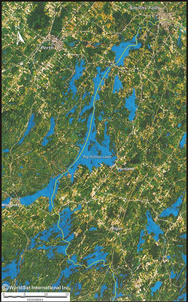
Landsat-5 Image of Whitefish Lake to Smiths Falls
This is a photograph of the central Rideau Waterway area taken from space in 1989. The navigation route is shown by the dashed yellow line. Topography can be seen by the type of cultural use. Flatter land is being farmed (light yellow rectangles). Dark green areas represent either more rugged topography, or wetlands.
This image is a scanned portion of a poster "Kingston / Thousand Islands from space" published by WorldSat International Inc., and used here with their permission. For more information about WorldSat products, visit their website at www.worldsat.ca
|