This is an easy paddling river section of the Rideau River, with lots of marshland bordering the river in this area. The map included in this guide can be enlarged (while viewing the PDF) to any level of detail you desire as an aid for travel planning.
Water access is available at Edmunds Lock, Kilmarnock Lock and at Merrickville. For the paddler the easiest is either Edmunds (ramp - 44° 52.600'N - 75° 59.020'W) or Kilmarnock (shoreline - 44° 53.060'N - 75° 55.820'W) - both lockstations offer plenty of parking. In Merrickville the main water access is a ramp in the Lions Park Campground (44° 55.000'N - 75° 50.350'W).
Facilities
Lodging: If you're paddling and camping, the lockstations are a good choice for camp spots (a camping fee applies). There is also the Lions Park Campground in Merrickville, a host of B&Bs and several hotels (Merrickville and Smiths Falls). For information about local accommodations see: www.rideauheritageroute.ca, www.smithsfalls.ca, www.realmerrickville.ca, and www.rideau-info.com (this website).
Supplies: A local source for supplies is the town of Smiths Falls which has which full facilities (grocery stores, pharmacies, hardware stores).
Etiquette
Your trip planning should include a "leave no trace" approach - carry out what you carry in. Many areas are un-serviced (no garbage cans) - so plan to be self-contained. The lockstations provide waste disposal facilities.
Preparation
Please read the trip planning information on www.rideau-info.com/canal/paddling/ While these lakes are easy paddling, normal paddling preparations should be made (all required safety gear, maps, food, water, first-aid kit, etc.). Although the map in this guide is a very accurate 1:50,000 representation of the lakes, it is recommended that you carry either the1:20,000 hydrographic chart (Chart 1513) or the 1:50,000 NTS map (31C/9). Please take all normal safety precautions, including checking the weather forecast before you head out and making sure that someone on shore knows your planned travel route and itinerary.
Distances:
Edmunds Lock to Kilmarnock Lock along the navigation channel = 6.0 km (3.7 mi)
Kilmarnock Lock to Merrickville Locks along the navigation channel = 12.5 km (7.8 mi)
Edmunds Lock to Merrickville Locks along the navigation channel = 18.5 km (11.5 mi)
The Rideau River
The Rideau River is generally a slow moving river, the only appreciable currents will be from the outflow of the canal weirs during times of high water. The main hazard are these same weirs, some with overflow dams. These are well marked on the upstream side and paddlers should avoid getting too close to these. Zebra mussels are present. Aquatic vegetation growth is present in most sheltered areas with a depth of less than 3 m (10 ft). Wildlife is abundant, particularly herons, ospreys, turtles, frogs, muskrats and beaver. The main game fish in the water is large mouth bass (small mouth bass and northern pike are also present).
Edmunds Lock to Kilmarnock Lock
In the pre-canal era, the river was about 0.6 m (2 ft) lower than it is today at the foot of Edmunds, and about 1.8 m (6 ft) lower at the head of Kilmarnock. The completion of the lock and weir at Maitland's Rapids (today's Kilmarncok) in the fall of 1831 raised the water in the river to the level it is today. Water levels are managed by Parks Canada.
The river channel has a maximum depth of 3 m (10 ft). The water depth outside of the marked channel averages about 1.2 m (4 ft). The land bordering the river is all privately owned except for the federal lands at the lockstations. There is little cottage/home development in this section, just a few spots where there is road access to non-marshland shorelines.
Kilmarnock Lock to Merrickville
In the pre-canal era, the river was about 1.1 m (3.5 ft) lower than it is today at the foot of Kilmarnock, and about 2 to 2.5 m (6 to 8 ft) lower at the head of Merrickville. The completion of the lock and weir at Merrickville in 1831 raised the water in the river to the level it is today. Water levels are managed by Parks Canada.
The river channel has a maximum depth of 4.6 m (15 ft). The water depth outside of the marked channel averages about 1.2 m (4 ft). The land bordering the river is all privately owned except for the federal lands at the lockstations. There is only a few spots with cottage/home development in this section, locations where there is road access to non-marshland shorelines.
The Locks
Most Rideau lockstations offer facilities such as washrooms, water, recycling cans, waste cans and picnic tables. Most also allow camping for paddlers travelling the Rideau for a modest camping fee. Paddlers can portage the locks for free, but you owe it to yourself to lock through at least one lock in order to get the full experience of paddling the Rideau Canal. A single lockage and return (2010 fee) is $0.90 per foot (minimum charge of 12 feet) - so if your kayak is 14 feet long, it would only cost $12.60.
Points of Interest (listed south to north)
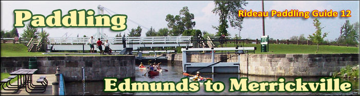
Edmunds Lock: this lockstation has a single lock, a weir and an overflow dam. It has a lift of 2.8 m (9.2 ft). A two-storey lockmaster's house is located on site (the lockstation office today). Edmunds, accessed by road from County Road 17 (south side of the Rideau River) features extensive grounds (verdant lawns with large shade trees), lots of parking, and a boat launch.
Rideau River - Edmunds to Kilmarnock: a peaceful section of the Rideau River with lots of wildlife viewing opportunities in the marshy borders of the river.
Kilmarnock Lock: this lockstation has a single lock and a weir. It has the lowest lift of any lockstation on the Rideau at only 0.7 m (2.2 ft). It also has one of only four remaining unequal arm, center bearing timber swing bridges on the Rideau. It has a two storey lockmaster's house, used today as the lockstation office.
Rideau River - Kilmarnock to Merrickville: extensive marshlands, including the Big Marsh, affords marshland wildlife viewing opportunities. The river also passes by the outlet of Irish Creek, once considered as a route for the Rideau Canal (see below). Just upstream from Merrickville, on the south side of the River is the Rideau Migratory Bird Sanctuary - a spot used by birds in spring and fall as a staging ground for their migration.
Irish Creek: this creek has its origins in Irish Lake. The building of the canal flooded the creek up to Jasper. In his 1816 survey of the Rideau Route, Lt. Joshua Jebb of the Royal Engineers recommended that the route be taken by way of Irish Creek rather than through the Rideau Lakes. The canal would have gone up the creek to Irish Lake and then a five mile long railroad was proposed to link the route to Upper Beverley Lake and from there to Lower Beverley Lake and up Morton Creek to re-join the present-day route of the Rideau Canal. The Irish Creek route was discounted by the next survey (that of Samuel Clowes in 1823/24). See Irish Creek in the Off the Beaten Path section.
Merrickville: there are three detached locks at this location (total lift of 7.6 m / 25.0 ft). The lockstation office is located adjacent to the middle lock. The largest blockhouse on the Rideau Canal is located beside the upper lock. It is operated as a museum by the Merrickville and District Historical Society. The grassy picnic area beside the upper lock is known as Blockhouse Park. On the upstream side of the park, you'll find The Depot, the interpretive centre and retail outlet of Friends of the Rideau.
Merrickville is a very pretty village, filled with various artisan shops and stores that cater to visitors.
Off The Beaten Path
Irish Creek
Once considered as a potential route for the Rideau Canal, this is a slow moving meandering creek. The total distance from Roses Bridge (at the outlet of the creek to the Rideau River) to Irish Lake is 16.4 km (10.2 mi). The distance from that bridge (44° 51.490'N - 75° 54.860'W) to Jasper is 4.4 km (2.7 mi). This is a section flooded from the canal dam at Merrickville and features large areas of marsh and lily pads.
At Jasper, you'll find a very low concrete bridge. Depending on water levels, you should be able to slip a canoe or kayak under the bridge (remember to duck). The distance from Jasper (44° 50.015'N - 75° 55.900'W) to Irish Lake is 12.0 km (7.5 mi). The creek may be dammed in places by beavers, a few years ago I encountered the first beaver dam 2.5 km (1.5 mi) upstream from Jasper.
Terms of use
This guide may be freely used for personal purposes. Have fun on your Rideau paddling adventure.
Commercial use is not allowed in whole or in part without express written permission.
Have you found this website useful? It is a non-commercial site run (and paid for) on a hobby basis by Ken Watson. You can help with its continued development by making a donation using PayPal (credit card) - just click on the button