|
Includes the lower Cataraqui River
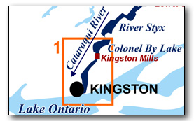
This area is bounded by the City of Kingston at the south end (the Lasalle Causeway marks the southern limit of the Rideau Canal) and the bottom end of Colonel By Lake to the north. It includes Cataraqui Bay - the foot of the Cataraqui River. The southern area has exposed open water and is subject to wave action so paddlers, particularly canoeists, should ensure that they do a weather check to make sure the winds are light prior to heading out.
No specific route descriptions have been given. The map included in this guide can be enlarged (while viewing the PDF) to any level of detail you desire as an aid for travel planning.
You can view or download the PDF file:
| Click on the link to open the PDF. You can also just right mouse click the above link and use "Save Target As" to send the PDF directly to your computer.) |
You can also view a short photo tour video of this area:

Water Access
At the south end the quietest access is the small concrete ramp (44° 14.550'N - 76° 28.790'W) in Emma Martin Park (formerly Orchard Park) at the foot of Cataraqui Street. It's located adjacent to the Cataraqui Canoe Club. There is also the public ramp at the foot of West Street (44° 13.430'N - 76° 29.140'W), but the caveat with this is that you're putting into Lake Ontario which can have severe waves. There are also several marinas in this area; Rideau Marina, Kingston Marina and Confederation Basin Marina.
At the north end, there is the Kingston Mill Locks - although a portage will be required to either the top or bottom of the locks from the parking area. You can also put into Colonel By Lake at the beach or ramp at Rideau Acres Campground (44° 18.440'N - 76° 25.560'W).
Facilities
Lodging: If you're paddling and camping, the lockstations are a good choice for camp spots (a camping fee applies). There are also campgrounds, B&Bs and hotels/motels in Kingston. For information about local accommodations see: www.rideauheritageroute.ca and tourism.kingstoncanada.com
Supplies: A local source for supplies is Kingston (full services).
Big Boats
You'll be sharing the Rideau with big power boats (cruisers). The Rideau is generally not a crowded waterway and often you'll find the large boats in "packs" - travelling from lock to lock - once they pass by you won't see any for awhile. Some of these boats can generate a large wave. The general rule for a paddler and large waves is to meet them head on, this can actually be fun in a kayak (not as much fun in a canoe). Many power boaters are considerate to the paddler and slow down, although this can sometimes cause a problem as a big boat goes from high to low speed, generating a large wave in the transition. So, be on the lookout for this.
The main navigation channel is shown on the map as a blue dashed line - this is where the big boats will be travelling. So, if you wish to avoid these, pick a route away from the navigation channel. Many paddlers prefer paddling near shore, it's more interesting (i.e. wildlife, cottages) and it keeps you farther away from the waves produced by big boats.
Also marked on the maps are the 10 kph ( watch your wake) zones. These are marked on the water with buoys. The start of these zones can be problematic for the paddler as power boats generate large transition waves (going from high to low speed and vice-versa). Also, not all power boaters are aware of the size of the wave they are generating, even in the 10 kph zones. So, be aware of this.
Wind
A question often asked is which way does the wind blow? The prevailing wind, powered by the jet stream, is from the southwest. That's about the only rule of thumb. If a front is moving in then the wind can come from any direction. I've been on several paddles where I've been paddling into the wind on the way out in the morning and into the wind on the way back in the afternoon because the wind swung around 180 degrees (for some reason it never seems to work the other way around - at your back both ways). So, if you're going to travel the entire Rideau, going from Kingston to Ottawa improves the odds of having the wind at your back - but be prepared for anything.
Preparation & Safety
Please read the trip planning information on www.rideau-info.com/canal/paddling/. While these lakes are easy paddling, normal paddling preparations should be made (all required safety gear, maps, food, water, first-aid kit, etc.). Zebra mussels are present in many areas along the Rideau, so a pair of water shoes (to avoid cut feet) is recommended.
Please take all normal safety precautions, including checking the weather forecast before you head out and making sure that someone on shore knows your planned travel route and itinerary.
Navigation
While the Rideau is generally easy to navigate, taking along a set of maps is a must (in addition to any GPS you might have). Although the map in this guide is an accurate 1:50,000 representation of the waterway (when printed to 8.5" x 11"), you may also wish to also have the 1:20,000 hydrographic chart for this section (Chart 1513). For power boat navigation, the charts are an absolute must (the map in this guide should not be used for power boat navigation). The charts are also very handy for the paddler, since they show the Rideau in great detail, including depths (which can be helpful when looking for wildlife habitat or just interesting places to paddle).
The charts also show all the navigation buoys. These are all numbered (red buoys have even numbers, green buoys have odd numbers) and so can be used as an aid in locating yourself on the map when you're on open water. A subset of those buoy numbers have been included on the paddling guide maps.
For those wishing to go off the beaten path or want to know more of the topography and geographic features of the surrounding countryside, the 1:50,000 NTS map for this section are 31C/1 and 31C/8.
Distances:
Circumference distances are approximate, following the main shorelines & bays. The navigation channel is shown on the map.
- Lasalle Causeway to Kingston Mills along navigation channel: 6.9 km (4.3 mi)
- Cataraqui Bay (Lasalle Causeway to Kingston Mills) circumference: 18 km (11.2 mi).
Cataraqui River
Lasalle Causeway to Kingston Mills Locks
In the pre-canal era this area was much the same geographically as it is now, the outflow of the Cataraqui River through marshland. Some of the geography is affected by the rise and fall of Lake Ontario, which since 1918 has shown a fluctuation of 4.6 feet / 1.4 m (which is close to the 4 foot / 1.2 m fluctuation of the lake noted by surveyor Samuel Clowes in 1824). There was some minor deepening of shoals during the construction the canal.
Belle Island (originally Bell Island) was a height of land in a swampy area - much of that swampy peninsula (a golf course today) has been filled - but the originally outline remains mostly unchanged.
One of the earliest detailed maps we have of this area, Joshua Jebb's 1816 map, shows essentially what you will be paddling through today.
An interesting geographic features in this area is the southern limit, on the Rideau Canal, of the Frontenac Axis, a neck of the Canadian Shield (very old metamorphic and intrusive rocks). This is located just south of Kingston Mills and you'll see it as a significant topographic change caused by exposures of granite and syenite just north of Highway 401.
In the southern section of the Cataraqui you'll see a fair bit of urban development on or near the shoreline but as you paddle north this changes into natural shorelines (marshlands).
The Lakes
Colonel By Lake
In the pre-canal era this was a meandering section of the Cataraqui River which wound its way to Cataraqui Falls (location of Kingston Mills Lockstation). The damming of the river at Cataraqui Falls with the building of the first mills in 1784 created the initial lake - a mill pond that extended to just south of Caseys Island. The lake was expanded to its current size with the completion of canal dam and extensive berms at Kingston Mills in 1831. This raised the water level at this end of the lake by 26 feet (7.9 m).
The lake is shallow, the deepest point is 25 feet (7.6 m) and the lake averages about 10 to 15 feet (3.0 to 4.6 m). The shallow nature of the lake and the fact that it's at the lower end of the watershed means that it is nutrient loaded, the water normally being green (algae). A potential hazard located outside of the marked navigation channel are stumps (drowned trees), mostly in the northern part of the lake, with the tops just a few inches below the water at normal navigation level. Shallow drafting vessels such as canoes and kayaks will normally not have any problems with these except in times of low water. The green algae in the water make the stumps very hard to see.
The land bordering the lake is privately owned except for the federal lands around the lock. Much of the lake has moderate density cottage and summer home development.
The Locks
Most Rideau lockstations offer facilities such as washrooms, water, recycling cans, waste cans and picnic tables. Most also allow camping for paddlers travelling the Rideau for a modest camping fee. Paddlers can portage the locks for free, but you owe it to yourself to lock through at least one lock in order to get the full experience of paddling the Rideau Canal. See www.rideau-info.com/canal/fees.html for the current fee schedule.
Points of Interest (listed south to north)
Kingston: Known as the Limestone City for its many stone buildings, Kingston has many attractions. It's worth taking a wander through the downtown, starting with Confederation Park on the waterfront.
Kingston, in particular the naval harbour in Kingston, was the reason for building the Rideau Canal. Kingston was found to be potentially vulnerable to not being supplied with men and materials during the War of 1812 (war with the U.S.) since the supply route, from Montreal to Kingston, up the St. Lawrence, was in range of American guns. So the Rideau Canal was proposed (and eventually built) to create a safe supply route from Montreal to Kingston.
For details about Kingston visit the many Kingston websites.
Kingston Harbour: If you're in a kayak or a good canoeist (or it's a calm day) it's certainly worth a tour of the Kingston waterfront - to see Kingston and Fort Henry from the water. Check the weather before you do this. Early morning is usually best since wave action often increases as the day progresses.
Fort Henry: This fort was built to protect the naval harbour in Kingston. Today’s fort and the four associated Martello towers were built between 1832 and 1837 and are part of the UNESCO World Heritage Site that includes the Rideau Canal. The fort seen today replaced a much smaller fort originally built during the War of 1812. Fort Henry was garrisoned firstly by British troops and then by Canadian troops until 1891. In 1936 the first restoration project was done on the fort and it was opened as a public museum in 1938. It remains one of Kingston’s most popular tourist attractions. Visit www.forthenry.com for full details.
Lasalle Causeway: The LaSalle Causeway marks the southern limit of the Rideau Canal. The most prominent feature of the causeway is the Strauss trunnion bascule lift bridge, built in 1915-16. Paddlers can easily slip under the bridge. There is also a channel on the east side for small boats which has a clearance of 4.3 m / 14 ft. The earliest bridge in this location may date to 1819 but the first documented bridge dates to 1829, a wooden bridge on masonry piers with a draw bridge at the west end (later replaced by a swing bridge). The causeway, opened in 1917, has three bridges, one at each end and the bascule lift bridge in the centre. The end bridges, originally steel truss bridges, were replaced with concrete beam bridges, the east bridge in 1962 and the west end bridge in 1993.
The LaSalle Causeway is named after René-Robert Cavelier, Sieur de La Salle, a French explorer who oversaw the construction of Fort Frontenac in 1673 (area to the western (downtown) side of the causeway).
Cataraqui Bay/Cataraqui River: There are urbanized shorelines until you get north of Belle Island (originally called “Bell’s Island”). The west side of the river from this point north features extensive marshlands.
Waaban Crossing: This high level fixed bridge, known as the “Third Crossing” during construction, was opened in late 2022. Waaban is an Anishinaabemowin (Ojibwe) word that has several meanings and interpretations relating to the eastern direction where the sun comes up, the dawn of a new day or the morning light.
Highway 401 Bridge: This is a fixed high level (6.7 m / 22 ft) bridge which carries Highway 401 across the Rideau Canal. It was built in the late 1950s (lane expanded in 2017-2020).
Frontenac Axis: Just north of the Highway 401 Bridge you'll see the topography start to change, with granitic outcrops marking the southern edge of the Frontenac Axis. These are very old rocks, originally formed 1.35 to 1.06 billion years ago (Precambrian: middle to late Proterozoic age) and then deformed and metamorphosed 900 million years ago. These rocks are part of the Canadian Shield. The rock types that you'll be able see as you travel through the Frontenac Axis include granite, syenite, monzonite, migmatite, gabbro, quartzite, marble, gneiss, pegmatite and conglomerate. Many of the lakes are underlain by marble (crystalline limestone) which provides some buffering against acid rain. This neck (axis) of rocks connects the extensive area of the Canadian Shield to the north and the Adirondack mountains to the south. On the Rideau, the Frontenac Axis extends to the northern part of Big Rideau Lake. On either side of the Frontenac Axis are younger, 520 to 460 million year old (Paleozoic: Cambrian to Lower Ordovician age) rocks including limestones, sandstones, dolomites and shales (laid down in a shallow sea that covered this area at that time). For more information see the Geology section. For more information see the Geology Page.
Kingston Mills Railway Bridge: The first railway bridge, a wooden bridge, was built by the Grand Trunk Railway in 1855. In 1890 it was rebuilt as a steel bridge with a double track and in 1924 the pier stands were rebuilt with concrete. It is presently owned and used by the CNR.
Cataraqui Falls: The hard granitic rocks of the Frontenac Axis in this area are the reason for the Cataraqui Falls, the lower part of which can still be seen today (the dam, basin and power dam cover the upper part of the falls). A native portage used to lead around the falls for paddlers travelling along the Cataraqui River. These falls, which originally had a drop of about 20 feet (6.1 m), were the site of the first mills in the area, the King's Mills, built in 1784. A succession of both timber mills (1794-1863) and grist mills (1794-1904) were built here. In 1913-14, the hydro generating station that can be seen today was installed.
Kingston Mills Lockstation: This lockstation features four locks, three in-flight and a detached lock. The total lift is 48.0 feet (14.6 m). The lockmaster's house (Robert Anglin House) now serves as an visitor's centre for the locks. The small blockhouse dates to 1832 and is one of only four built along the Rideau. It has been restored to the military period and is sometimes open with an interpreter.
An interesting configuration at Kingston Mills is the basin formed by the old dam and the new dam. Originally there was just the stone dam with incorporated waste water weir (sitting on the bedrock head of Cataraqui Falls). When it was proposed to add a hydro generating station in 1913, a new concrete dam was built below the stone dam - this formed the basin. The configuration is such that the Rideau Canal (Parks Canada) maintains full control the water flow (via their weir).
Note too the large berms to both the east and west of the locks (rebuilt in 2004). Originally, two locks were going to be placed farther upstream (at Jack's Rifts and Billidore's Rifts), but as with all the lockstations, plans had to be changed to meet conditions. It was decided to put all the locks at Kingston Mills and raised the water from here all the way to Lower Brewers. This meant creating these large embankments (berms) to help impound the water.
The original bridge across the upper lock was a double leaf timber drawbridge built in 1831. It was replaced some time later by a wooden swing bridge (easier to use than a drawbridge). In 1956 a steel through plate girder swing bridge was installed. That bridge was replaced by another steel swing bridge in 1988.
The first bridge at Kingston Mills was a fixed timber bridge, placed across Cataraqui Falls, when the Kingston-Montreal road was completed in about 1801. In 1909 a steel bridge was built to replace the previous wooden structure. This fixed bridge has been rebuilt over the years and it is now scheduled to be replaced prior to 2020.
The railway bridge that crosses the locks was first constructed by the Grand Trunk Railroad as a wooden bridge in 1855. In 1890 it was rebuilt as a steel bridge with a double track and in 1924 the pier stands were rebuilt with concrete. It is presently owned and used by the CNR.
The locks bypass Cataraqui Falls of which only the lower portion is visible today (the canal dam is built on the head of the falls). A native portage used to lead around the falls. These falls, which originally had a drop of about 20 feet (6.1 m), were the site of the first mills in the area, the King's Mills, built in 1784. A succession of both timber mills (1794-1863) and grist mills (1794-1904) were built and used here.
.
Colonel By Lake: The west side of this man-made lake is mostly undeveloped (farm frontage) while the east side has cottage and summer home development - so you'll find the best wildlife viewing opportunities along the west shoreline. The foot of the channel at the head of the lake (Harriet Point) is the location of Jack's Rifts - a small set of rapids (now drowned) where a lock was originally proposed.
Colonel By Lake Stumps: If you're off the navigation channel in the northern part of the lake, you may notice some stumps sitting a few inches underwater. These are what is left of the forests of the region, which were drowned when the water was raised with the building of the locks, dam and embankments at Kingston Mills. These are still rooted trees, if you're carrying the navigation charts you'll be able to see how tall these are (if you see a stump in 20 feet of water, you're looking at the top of a 20 foot tree trunk).
When the Rideau Canal was built, Colonel By had a wide (about 60 m / 200 ft) swath cut through the existing forest in the vicinity of the Cataraqui River between Kingston Mills and Upper Brewers before the area was flooded. This cut path followed a much straighter line than the meandering river and this is what today's buoyed navigation way represents. Canal era maps show this cleared route in relation to the original meandering river. The forests on either side of this cleared channel were simply drowned.
Most of these and other stumps that you will see in standing water on the Rideau Canal date to about 1831, when the canal dams were completed and the area above those dams flooded. If the tree was 100 years old when flooded, then you're looking at a tree stump that started off as a sapling in 1731.
In the case of Colonel By Lake, the original mill dam (for the King's Mills and subsequent timber and grist mills) flooded the Cataraqui River and surrounding forest up to the area of Caseys Island, starting in 1784. So, some of the stumps in that area may date back to that time. Originally they were full size dead trees. A few were cut but most have simply been broken or rotted off at the ice line.
A painting showing River Styx in 1844 shows a forest of dead standing timber, many with either an Osprey or Great Blue Heron's nest near the top. Herons in particular prefer to make a nest at the top of a dead standing tree, there are still heron rookeries (nesting areas) today in swampy areas with dead trees bordering the Rideau Canal.
Route Suggestions
The only suggestion, other than your own putterings, is to make sure to take a poke up the river to see Cataraqui Falls. When you come to the foot of the locks at Kingston Mills, stay in the river (bearing east/right), head under the railway bridge and paddle up to the falls (only 300 m / 1,000 ft from the locks).
Geology
As you paddle the Rideau Canal, the route you follow is defined by its geology. Geological highlights have been included in the Points of Interest listings and a general geological history of the route can be found on the Geology of the Rideau Page.
Wildlife Viewing
A section about wildlife viewing, what you might expect to see on your Rideau journey, has been included in text form in the PDF. A version of this information, that includes photos of some typical Rideau wildlife, can be found on the Fauna of the Rideau Page (in the ecology section of this website).
Errors
If you find any errors or omissions in this guide, please let me know (rideauken@gmail.com) and I'll get them fixed.
Terms of use
This guide may be freely used for personal purposes. Have fun on your Rideau paddling adventure.
Commercial use is not allowed in whole or in part without express written permission.
©2010- Ken W. Watson, All Rights Reserved.
You can view or download the PDF file:
| Click on the link to open the PDF. You can also just right mouse click the above link and use "Save Target As" to send the PDF directly to your computer.) |

|