Watersheds
For various maps of the Rideau, including a profile (side view) of the waterway, please see the Maps Page of this website
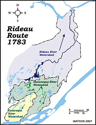
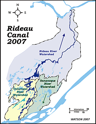
Prior to European settlement, the Rideau Route spanned three watersheds. The main drainage separation was the same as it is today, the Isthmus, the height of land that separates today’s Upper Rideau Lake from Newboro Lake. To the north, water from Rideau Lake (then one big lake) drained into the Rideau River which flowed north to the Ottawa River. However, unlike today, in the pre-settlement era there were two southern watersheds. The section from the Isthmus (Newboro) to Jones Falls, which included Newboro, Clear, Indian, Opinicon and Sand lakes, flowed to the Gananoque River via the White Fish River which flowed through the location of today’s Morton and into Lower Beverley Lake. Today that watershed boundary belongs to the Cataraqui River, for reasons which will be detailed later.
In the pre-settlement era the Cataraqui River had a much smaller watershed, its headwaters were Dog and Loughborough lakes. The only water contribution from the lower Rideau lakes (Newboro, Clear, etc.) was in times of spring flood, across the Cranberry Flood Plain. But once spring flood was over, this flood plain was above the normal water level of the White Fish River which was delivering its water to the Gananoque River. This was about to change.
|